

Part 2 of a series on the history of the Lakes Region.
Our last installment in this history series one ended with a line I haven’t stopped thinking about: competing claims on land that had never been understood as ownable in the first place. That’s where I want to start, except this time I’m not looking at the people. I’m looking at the paper.
I spend a fair amount of my working life inside chains of title. Part of the job of representing my clients well is making sure that when they sign on the dotted line, the title to what they’re purchasing is clear. Somebody wants to know how a piece of land got from there to here, who held it before them, whether anything upstream might come back to bite them. Most of the time the chain goes back sixty, eighty years and the story is boring in the way land records are supposed to be boring. And sometimes, folks are just curious about the history of their new home. Once in a while I get curious enough myself to keep pulling the thread past what’s useful for a transaction, just to see where it goes. And as I’ve been digging into the history of the region overall, I wanted to see where the first official thread in the tapestry started. That’s what this piece is, the first thread, which is pretty frayed as it turns out.
Our story starts back in 1629.
That year, three documents were produced that, between them, invented this place I now call home on paper. Two came from a room in England. One is supposed to have originated here, but probably didn’t.
Let’s start with the one that claims to be local. On May 17, 1629, four Pennacook sagamores, Passaconaway, Runaawit, Rowes, and Wehanownowit, reportedly deeded a swath of land between the Merrimack and Piscataqua rivers, roughly thirty miles by thirty, to a handful of Englishmen including a minister named John Wheelwright. In exchange, Passaconaway was to receive one coat of trucking cloth a year, and his people kept the right to fish, fowl, hunt, and plant on the land they’d just supposedly signed away. It reads, on its face, like an unusually respectful and mutually beneficial transaction for its era.
Here’s the problem. Nobody saw this deed until 1707, discovered in a file in a Maine registry, seventy-eight years after it was dated and twenty-eight years after Wheelwright died, in the middle of a lawsuit over land it happened to cover. Wheelwright himself didn’t even arrive in New England until 1637, eight years after he supposedly executed it. Historians have been arguing about it since the 1820s. The current scholarly consensus, as far as I can find it, leans toward forgery. Not a shady side deal. An invention, out of whole cloth as my grandma used to say, assembled decades later to backfill a signature nobody had actually gotten.
But let’s imagine for a minute it had been real. Say Passaconaway sat down and put his mark on exactly that document, freely, in full possession of his considerable diplomatic sense, which piece one already made clear was formidable. Would it have meant what the English needed it to mean?
I don’t think that’s a rhetorical question with an easy answer, and I want to be careful here, because it’s not about anyone being fooled. Abenaki land relations, as best as the scholarship lays them out, were built around territory and use, who had the right to hunt, fish, plant, and move through a given stretch of ground, often shared across bands and seasons, tied to kinship and reciprocal obligation. It was a complex system. What doesn’t seem to have entered into that complex system is the specific idea the English were operating under: land as a fixed, exclusive, permanently transferable asset, the kind of thing one party could hand to another forever and then no longer have any claim to at all. Even the terms of the disputed deed hint at this mismatch. Reserved fishing and hunting rights, an annual coat of cloth. That’s not the language of a sale. That’s the language of an ongoing relationship, which is closer to how territory seems to have actually worked here before contact. If the two sides had genuinely sat down together, they might both have walked away certain they’d understood each other, and still have been describing two different transactions.
Now the other two documents, made in England, by Englishmen, about land none of them had ever walked.
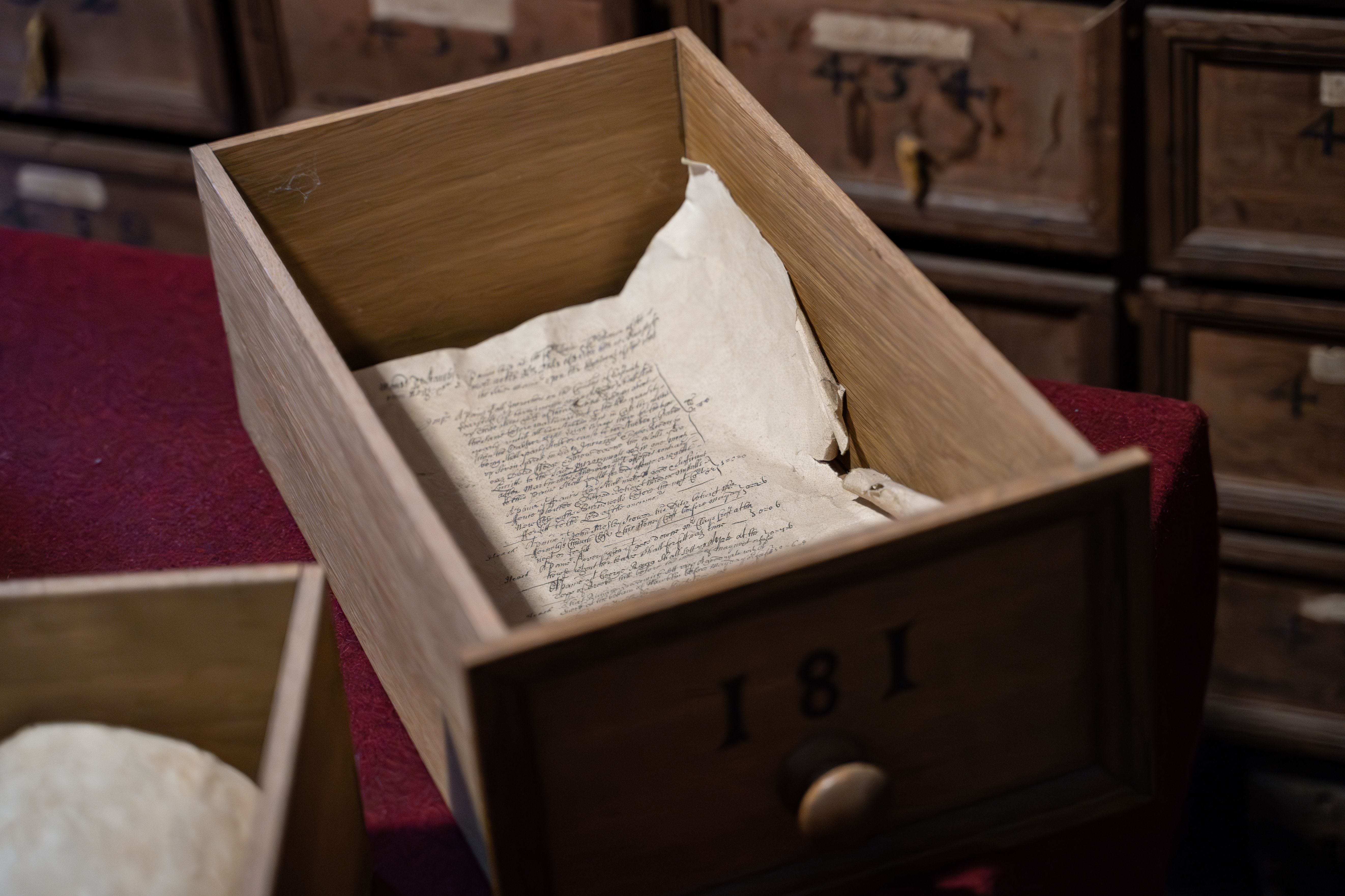
On November 7, 1629, the Council for New England granted Captain John Mason a tract between the Merrimack and Piscataqua rivers and called it, for the first time on paper, New Hampshire. Ten days later, on November 17, Mason and his partners secured a second grant just to the west, for a region they named Laconia, from the Latin for lake country. They believed it bordered Lake Champlain. It didn’t. Mason had gotten the Piscataqua’s headwaters wrong by roughly a hundred miles. He named a lake region for lakes he’d misplaced on a map representing land he’d never stood on.
I want to sit with that for a second, because it’s the detail that got me. The name that eventually becomes Laconia, the actual town, the actual region I live in, the words on my own listing sheets, originated in a clerical error made by a man in London who thought this place bordered different water entirely. Land can be surveyed wrong. A boundary can be off by a chain or two. But this was invented sight unseen, on the strength of a guess, and the guess stuck.
Between them, those two documents cover the same eighteen days in November 1629. Neither one involves anyone who was actually here. And the one document from that same year that does claim to involve the people who were here is the one nobody can vouch for.
Fast forward. Mason’s grant passed down through his family for a century, getting less useful and more disputed with every generation, until 1746, when a descendant six times removed, John Tufton Mason, sold the whole claim to twelve Portsmouth investors for fifteen hundred pounds. They called themselves the Masonian Proprietors. It’s their patent that eventually produces the actual town charters across the interior of New Hampshire, this region included, starting in the 1750s and 60s.
Wolfeboro’s charter is dated October 5, 1759, signed by Governor Benning Wentworth, naming the town for a general who’d died that same year at Quebec. Read the charter language and you get the standard formula of the period: land divided into shares among a small group of Portsmouth men, most of whom never set foot here, the crown reserving every white pine tree of a certain size for the Royal Navy’s masts, a nominal yearly rent of one ear of corn if demanded, later replaced by a shilling per hundred acres, payable each December at the council chamber back in Portsmouth. The town existed on paper for nine years before it existed as a town. First settlement wasn’t until 1768. Incorporation came in 1770. By the time any of that happened, sustained Abenaki presence in this immediate area had already thinned considerably, a slower unraveling that piece one already walked through in more depth than I want to repeat here.
I wonder what my clients would say if I told them their five acres, likely valued today somewhere in the $500-$700K range if there’s a livable house on it, was once worth a few kernels of corn.
Before the Farmhouses

I don’t have Abenaki ancestry, and I’m not an historian. This isn’t my story to tell from the inside, and I want to be be totally transparent about that. What I can offer is some observations, imperfect at best, pulled from what’s documented. I did a deep dive into available sources, read carefully and have attempted to base the argument I want to make …
Here’s where the work I actually do bumps into this. Real estate has a formal name for the problem I raised earlier about Passaconaway and Wheelwright. It’s called a meeting of the minds. A contract, including a deed, isn’t valid just because two parties signed it. Both parties have to be agreeing to the same thing, understanding the transaction in the same terms. That’s not a capacity question. It’s not about who was sophisticated enough to negotiate, because everything about Passaconaway’s documented diplomacy argues against that reading. It’s a translation question. If one side is agreeing to shared, ongoing, seasonal use and the other side believes it’s receiving permanent, exclusive ownership forever, they can both sign in good faith and still not have made the same deal. Modern property law spends a lot of effort making sure that gap can’t happen, precisely because land is wealth and wealth transfers this size don’t get undone. There was nothing here doing that work in 1629, and I’d guess the ambiguity suited exactly one side of the table, if there ever was a table and document in 1629 at all.
What I keep coming back to isn’t any single document. It’s the shape of the whole chain. Council grant to Mason. Mason to his descendants. Descendants to the Masonian Proprietors. Proprietors to Wentworth’s charters. Charters to the actual parcels that, a few sales later, become the addresses I pull up on a Thursday afternoon to made a recommendation for what we should list at in this current shifting market. At no point in a hundred and thirty years does a real, verifiable signature from anyone who already lived here appear in that chain. The only attempt to include one is the one that scholarship now doubts existed at all, and even if it had existed, I’m not convinced it would have settled anything. And somehow, it doesn’t matter. Because at some point each lot did get a title that some clerk somewhere decided was clean, and now we can trace it from sale to sale in a way that protects my clients.
The land itself, of course, never asked to be named, granted, or misplaced on a map. It has just kept being beautiful lake country, long before and long after the paperwork existed.
If this made you think of someone who’d want to read it, send it their way.
Here's to reading the fine print, even when it's three hundred years old.
🧭 Jenn
Keys to the Lakes
